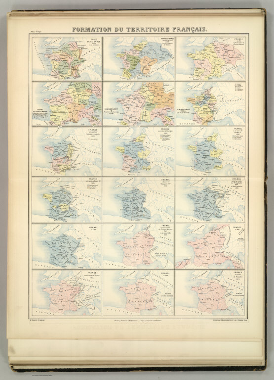
Formation du Territoire Francais. Atlas St. Cyr. G. Hue et E. Dubail. Furne, Jouvet et Cie. Editeurs. Imp. Lemercier et Cie. Paris. Grave par J. Geisendorfer, 12 r. de l'Abbaye, Paris. (1882)

Chimney Peak. Colorado Exploring Expedition frontispiece. J.J. Young from a sketch by H.B. Mollhausen. Lith. of Sarony, Major & Knapp, 449 Broadway, N.Y. In Charge. (Washington: Government Printing Office. 1861. Senate. 36th Congress, 1st Session. Ex. Doc.)
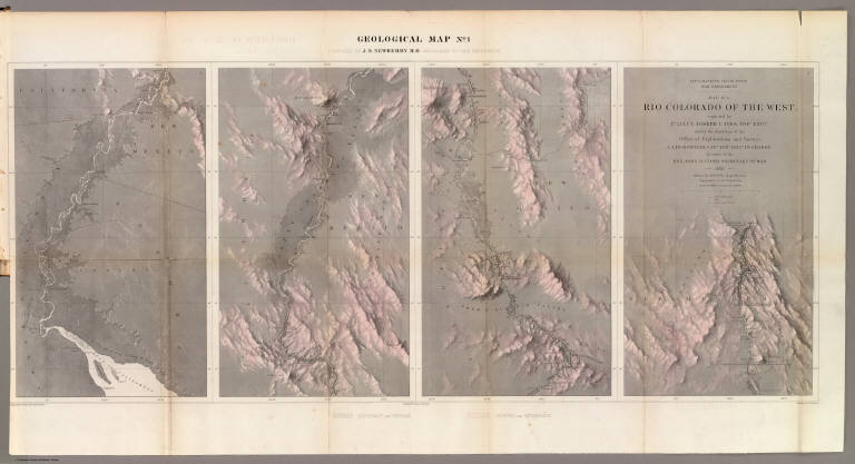
Geological Map No. 1. Prepared by J.S. Newberry, M.D. Geologist to the Expedition. Explorations and Surveys. War Department. Map No. 1. Rio Colorado of the West, explored by 1st Lieut. Joseph C. Ives, Topl. Engrs. under the direction of the Office of Explorations and Surveys. A.A. Humphreys, Capt. Topl. Engrs. in Charge, by order of the Hon. John B. Floyd, Secretary of War. 1858. Drawn by Frhr. F.W.v. Egloffstein. Topographer to the Expedition. Topography by Frhr. F.W.v. Egloffstein. Ruling by Samuel Sartain. Lettering by F. Courtenay.
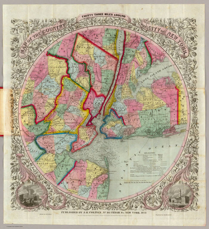
Map Of The Country Thirty Three Miles Around The City Of New York. Published By J.H. Colton, No. 86 Cedar St. New York, 1853. Entered ... 1846, by J.H. Colton ... New York. Drawn by G.W. Colton. Engraved by J.M. Atwood, N.Y.
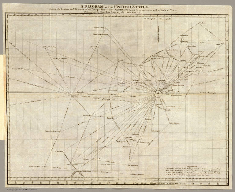
A diagram of the United States shewing the bearings and distances of the principal places from Washington, and from each other, with a scale of time. Prepared for the Travellers directory by John Melish. (Philadelphia: Published by the Author. 1822)
Gran archivo de mapas en David Rumsey Historical Map Collection .
No hay comentarios:
Publicar un comentario