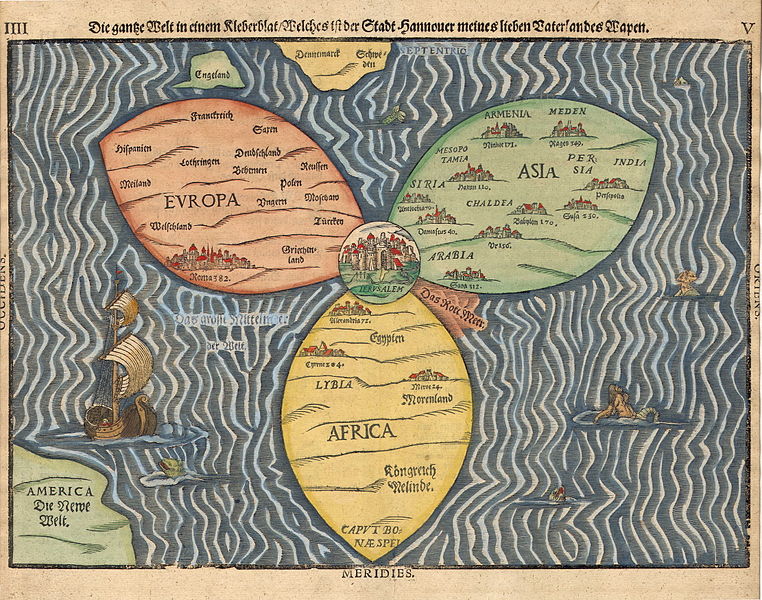
Bünting clover leaf map. A woodcut made in 1581 in Magdeburg. Jerusalem is in the center, surrounded by Europe, Asia and Africa.
Desde la Wikipedia.

The Tabula Peutingeriana (Peutinger table, Peutinger Map) is an itinerarium showing the cursus publicus, the road network in the Roman Empire. The original map of which this is a unique copy was last revised in the fourth or early fifth century.[1] It covers Europe, parts of Asia (Persia, India) and North Africa. The map is named after Konrad Peutinger, a German 15–16th-century humanist and antiquarian. The map was discovered in a library in Worms by Conrad Celtes, who was unable to publish his find before his death and bequeathed the map in 1508 to Peutinger. It is conserved at the Österreichische Nationalbibliothek, Hofburg, Vienna.También desde la Wikipedia.
No hay comentarios:
Publicar un comentario