26/1/10

Antártica/ Terra Australis


Antarctica, on average, is the coldest, driest, and windiest continent, and has the highest average elevation of all the continents.[2] Antarctica is considered a desert, with annual precipitation of only 200 mm (8 inches) along the coast and far less inland.[3] There are no permanent human residents but anywhere from 1,000 to 5,000 people reside throughout the year at the research stations scattered across the continent. Only cold-adapted plants and animals survive there, including penguins, seals, nematodes, Tardigrades, mites, many types of algae and other microorganisms, and tundra vegetation.

Although myths and speculation about a Terra Australis ("Southern Land") date back to antiquity, the first confirmed sighting of the continent is commonly accepted to have occurred in 1820 by the Russian expedition of Mikhail Lazarev and Fabian Gottlieb von Bellingshausen. The continent, however, remained largely neglected for the rest of the 19th century because of its hostile environment, lack of resources, and isolation. The first formal use of the name "Antarctica" as a continental name in the 1890s is attributed to the Scottish cartographer John George Bartholomew. The name Antarctica is the romanized version of the Greek compound word ανταρκτική (antarktiké), feminine of ανταρκτικός (antarktikos),[4] meaning "opposite to the north".[5]

(...)

An expedition led by Norwegian polar explorer Roald Amundsen from the ship Fram became the first to reach the geographic South Pole on 14 December 1911, using a route from the Bay of Whales and up the Axel Heiberg Glacier.[16] One month later, the ill-fated Scott Expedition reached the pole.


************************

The notion of Terra Australis was introduced by Aristotle. His ideas were later expanded by Ptolemy (1st century AD), who believed that the Indian Ocean was enclosed on the south by land, and that the lands of the Northern Hemisphere should be balanced by land in the south.[1] Ptolemy's maps, which became well-known in Europe during the Renaissance, did not actually depict such a continent, but they did show an Africa which had no southern oceanic boundary (and which therefore might extend all the way to the South Pole), and also raised the possibility that the Indian Ocean was entirely enclosed by land. Christian thinkers did not totally discount the idea that there might be land beyond the southern seas, but from St Augustine's time onwards they denied that they could be inhabited. The impossibility of crossing the ever more torrid space meant that descendants of Adam could not have travelled there, and in addition, since the Gospel was supposed to be made available to all of mankind, and could not have been brought there, no humans could dwell in those parts (although there were counter-myths going back to ancient time about the 'Antipodes', meaning people who lived opposite to us)


Más en la wiki sobre la Antártica y Terra Australis.

También interesante el Fram Muset.

Jeff Keen


Flik Flak (extract); Jeff Keen, 1963.


Instant Cinema; Jeff Keen, 1962/2007


GAZWRX; Jeff Keen, 1967

Gazwrx: The films of Jeff Keen

The BFI have just done us proud with a box set of Jeff Keen films entitled Gazwrx, not to mention various screenings of his works – and all from brand spanking new prints! Keen was one of the earliest and best British underground film-makers. He was largely self-taught and is blessed with a beatnik sensibility that converges with the hippie scene of the later sixties but remains a distinctive strand within it. As a starting point for all this, imagine a surrealist remake of Robert Frank’s Pull My Daisy (1959) set in Brighton and you’re not a million miles away from Like The Time Is Now (1961); except, of course, the comparison glosses over Jeff Keen’s singularity. Wail (1960) is probably more typical of Keen’s cinematic sensibility; a crazy mix of animation and live action footage featuring Hollywood werewolves, high art and gang violence. Using 8mm film, Keen created scratch video 20 years before anyone else had thought of it. The resultant mix and match of high art and lowbrow popular culture runs through forty years of his film work.

From the early sixties right through to the late seventies Keen worked with an ensemble of players who might be compared to the troupe John Waters deployed in his midnight movie hits before making the transition to Hollywood director. Although both men clearly set out to entertain their audiences, the similarities pretty much stop there because Keen created shorts not features, had no time for narrative and made extensive use of animation and double exposure. So the results are closer to Ira Cohen’s Invasion of Thunderbolt Pagoda (1968) than Pink Flamingos (1972). But as in John Waters’ far more conventional flicks, Keen’s ensemble of actors liked to dress up and act out as exaggerated comic book versions of themselves: and some of them were rather fond of taking their clothes off too, particularly Jeff’s wife Jackie Keen. One can sense from the films that there were sexual shenanigans going on off-screen that fuelled the bad craziness caught on celluloid. But if sex and nudity don’t do it for you, there are also cardboard ray guns, monsters, endless explosions of paint and other pyrotechnics. The titles of the films in the Gaswrx box provide a good indication of their content: Cineblatz, Marvo Movie, Meatdaze, The Cartoon Theatre of Dr Gaz, Return of Silver Head, Victory Thru Film Power, Kino Pulveriso, The Dreams and Past Crimes of the Archduke, Omozap, Artwar Fallout, Plasticator etc.

(...)


Continúa leyendo en StewartHomeSociety.

25/1/10

You Are Here: Personal Geographies and Other Maps of the Imagination; Katherine Harmon, 2004


The map is a subtle and beautiful art form that is often held for its merest and most mundane of functions: to get its reader from point A to point B. But a map, deconstructed, is so much more. As graphical representations of our geographic world, maps figuratively contain within them the living and changing lives of us all. Someday, perhaps, maps will be as dynamic as the worlds they detail. As with the charmed maps of J.K. Rowling's Harry Potter series, the symbols of the map will move and change with the movements of the objects they represent. For now, however, we must rely upon our imaginations to invoke the richness only hinted at on paper.

In You Are Here: Personal Geographies and Other Maps of the Imagination, Katharine Harmon has shared her own love of maps by collecting a broad-ranging variety of art form. Not content to praise the intrinsic art of the geographic map, Harmon calls our attention to the labors of imaginative mapmakers who have charted regions emotional, biological, historical, culinary, and…well, you name it, it's in there.
She begins with a petroglyphic map from 2500 B.C., and launches from there into a chapter on personal geographies, all of which explore the body and mind of the human animal. These include such maps as "Main Route of Expedition Through the Alimentary Canal," acupuncture diagrams, and group dream maps. Outstanding in this collection is Adolf Wolfli's maps of the "Island Neveranger." Wolfli was a schizophrenic committed to a mental asylum in Germany at the age of 31, who, while confined, produced a startlingly rich output of imaginative work that included maps from his richly imagined world. These are highly detailed and wonderfully colored works from Wolfli's rich imaginary iconography.
The next chapter, titled, "At Home in the World," is equally diverse. A poem from Howard Horowitz typeset into the shape of Manhattan Island took the author one-and-a-half years to write. This poem-map is quite stunning, but pales next to a the intricately detailed map of Srinigar, a village in Kashmir, India, that was hand-embroidered on a wool and cloth shawl in the 19th century. Works from celebrated artists appear here also such as a map from illustrator, John Held Jr., known for his early 20th century caricatures, and William Wegman's "Vacationland," a postcard collage in oils celebrating tourist attractions.
The final chapter, "Realms of Fantasy," focuses in on geographic maps of fantastic or fictional realms. These vary from Julia Ricketts' colorfully abstract "Notations on a River," which explores the interplay of natural and man-made landforms, to Mark Bennett's highly detailed map of the Town of Mayberry. My personal favorite in this section is a map entitled "The Great Bear," in which artist, Simon Patterson, transposes the names of historical figures onto a universally recognizable map of the London Underground. Tube riders can jump on the Blue Line at Michelangelo, change to the Yellow Line and take that East to Plato. Transferring to the Red Line can take the rider to Rupert Murdoch, Louis Pasteur, or even Dick Cheney.

Years before the publication of You Are Here, I met an artist whose painted upon GIS maps of various world regions. I was thoroughly captivated then, and I still am. Perhaps, as Katharine Harmon suggests, we humans have an innate urge to map.

Today, inspired by You Are Here, I built a "map" of plastic pails, shovels, and other sandbox toys with my children. I laid the foundation, a starting point and an ending point with roads drawn into the sand to connect the two, and then invited my kids to join in. Before it was over, they had built quite a sandbox menagerie that included roads, lakes, bridges, and even an amusement park, all symbolically arranged in sand and plastic toys. I don't know if it was innately motivated, but it sure was cool.

Info desde aquí.

24/1/10

Mapa de la cara cercana de la luna; Don E. Wilhelms y Jonh F. McCauley, 1971

The library of the Congress


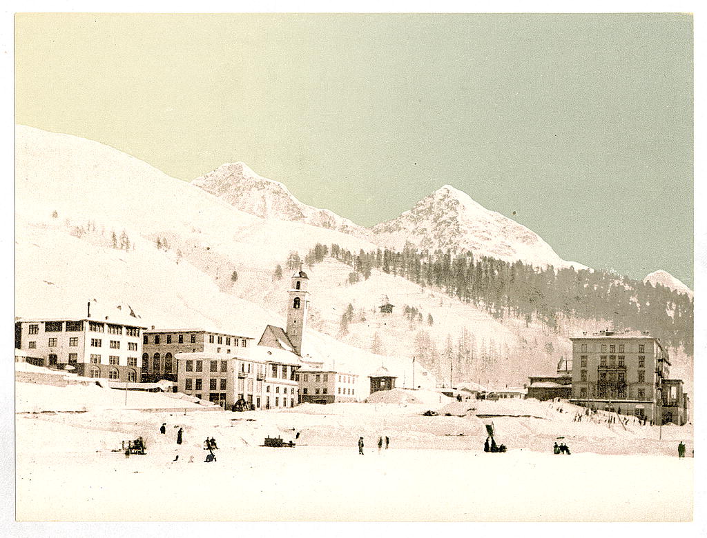
[St. Moritz, Grisons, Switzerland, in winter (reversed)]

[before 1890].

1 photomechanical print : photochrom, color.

Notes:
Photo shows the leaning tower of St. Maurice church before 1890 when the nave was torn down. (Source: Flickr Commons project, 2009)
"1011" stamped on the back of the print.
Title from identifying information provided by the Flickr Commons project, 2009. (Print not listed in the Detroit Publishing Company, Catalogue J, 1905.)
Forms part of: Nineteenth century travel views of Europe in the Photochrom print collection.

Format: Photochrom prints--Color--1890-1900.

Rights Info: No known restrictions on publication.

Repository: Library of Congress, Prints and Photographs Division, Washington, D.C. 20540 USA, hdl.loc.gov/loc.pnp/pp.print

Part Of: Nineteenth century travel views of Europe (DLC) 2002707970

More information about the Photochrom Print Collection is available at hdl.loc.gov/loc.pnp/pp.pgz

Persistent URL: hdl.loc.gov/loc.pnp/ppmsc.09997

Call Number: LOT 13512, no. 25 [item]


Bain News Service,, publisher.

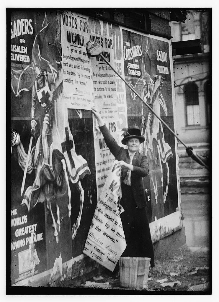
Suffragettes posting bills

[between 1910 and 1915]

1 negative : glass ; 5 x 7 in. or smaller.

Notes:
Title from unverified data provided by the Bain News Service on the negatives or caption cards.
Forms part of: George Grantham Bain Collection (Library of Congress).

Format: Glass negatives.

Rights Info: No known restrictions on publication.

Repository: Library of Congress, Prints and Photographs Division, Washington, D.C. 20540 USA, hdl.loc.gov/loc.pnp/pp.print

General information about the Bain Collection is available at hdl.loc.gov/loc.pnp/pp.ggbain

Persistent URL: hdl.loc.gov/loc.pnp/ggbain.10578

Call Number: LC-B2- 2417-13

O'Sullivan, Timothy H., 1840-1882, photographer.

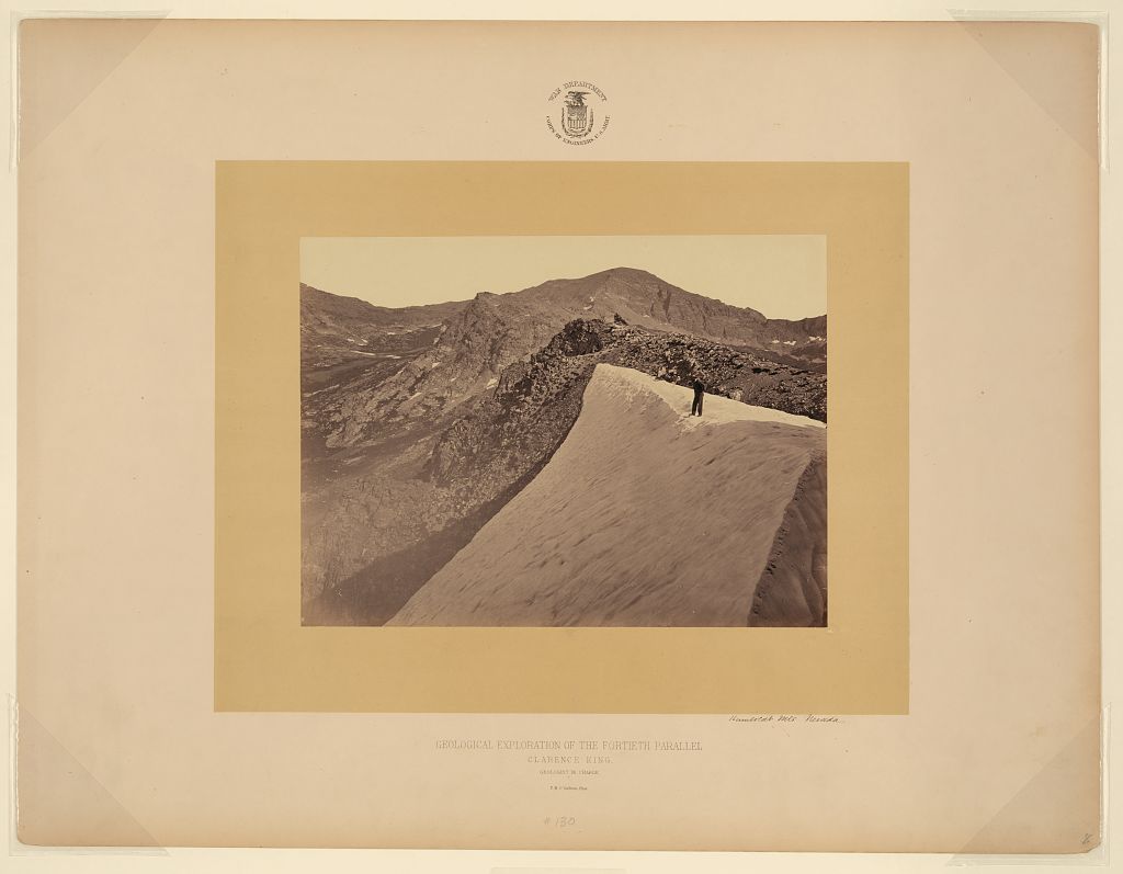
Humboldt Mts., Nevada

[1868]

1 photographic print : albumen.

Notes:
Title from item. Date from curatorial research in 2009.

Plate 130 from: Geological Exploration of the Fortieth Parallel / United States Army Corps of Engineers; Clarence King, geologist in charge. [Washington, D.C.; 187-?].
Photograph showing a man standing on snow on the mountain.

Published in: Framing the West: The Survey Photographs of Timothy H. O'Sullivan / Toby Jurovics, Carol M. Johnson, Glenn Willumson, and William F. Stapp. New Haven: Yale University Press, 2010, plate 22.

Subjects:
United States Geological Exploration of the Fortieth Parallel--(1867-1881)
Mountains--Nevada--1860-1870.

Format: Expedition photographs--1860-1870.
Landscape photographs--1860-1870.
Albumen prints--1860-1870.

Rights Info: No known restrictions on publication.

Repository: Library of Congress, Prints and Photographs Division, Washington, D.C. 20540 USA, hdl.loc.gov/loc.pnp/pp.print

Persistent URL: hdl.loc.gov/loc.pnp/ppmsca.11916

Call Number: LOT 7096, no. 130

Wolcott, Marion Post, 1910-1990, photographer.

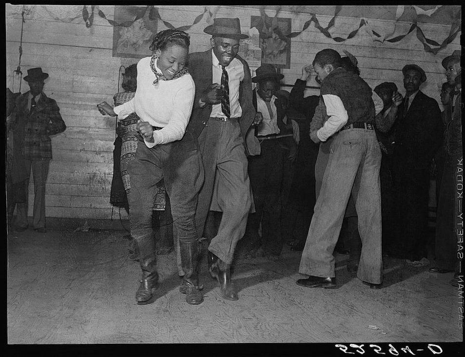
Jitterbugging in Negro juke joint, Saturday evening, outside Clarksdale, Mississippi

1939 Nov.

1 negative : safety ; 3 1/4 x 3 1/4 inches or smaller.

Notes:
Title and other information from caption card.
Transfer; United States. Office of War Information. Overseas Picture Division. Washington Division; 1944.

Subjects:
Clarksdale--Mississippi
United States--Mississippi--Coahoma County--Clarksdale.

Format: Safety film negatives.

Rights Info: No known restrictions on publication.

Repository: Library of Congress, Prints & Photographs Division, Washington, DC 20540, hdl.loc.gov/loc.pnp/pp.print

Part Of: Farm Security Administration - Office of War Information Photograph Collection (Library of Congress)

More information about the FSA/OWI Collection is available at hdl.loc.gov/loc.pnp/pp.fsaowi

Persistent URL: hdl.loc.gov/loc.pnp/fsa.8c36090

Call Number: LC-USF34- 052594-D


New-York tribune. (New York [N.Y.]) 1866-1924

July 11, 1909, Image 15

Notes: Cover, illustrated supplement.

Format: Newspaper page, from microfilm

Rights Info: No known restrictions on reproduction.

Repository: Library of Congress, Serial and Government Publications Division, Washington, D.C. 20540 USA.

Part Of: Chronicling America (Library of Congress) (DLC) - lccn.loc.gov/2007618519

Persistent URL: chroniclingamerica.loc.gov/lccn/sn83030214/1909-07-11/ed-...


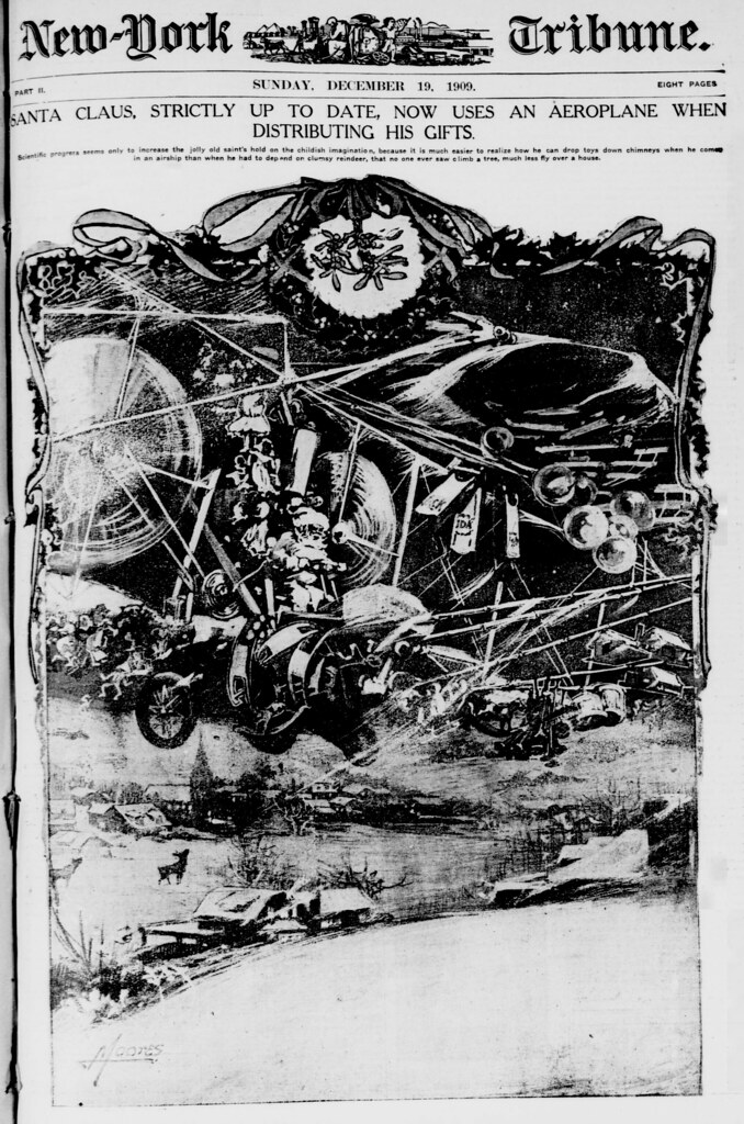
New-York tribune. (New York [N.Y.]) 1866-1924

December 19, 1909, Image 17

Notes: Cover, illustrated supplement.

Format: Newspaper page, from microfilm

Rights Info: No known restrictions on reproduction.

Repository: Library of Congress, Serial and Government Publications Division, Washington, D.C. 20540 USA.

Part Of: Chronicling America (Library of Congress) (DLC) - lccn.loc.gov/2007618519

Persistent URL: chroniclingamerica.loc.gov/lccn/sn83030214/1909-12-19/ed-...

What are photographs doing in a library? We've been acquiring photos since the mid-1800s when photography was the hot new technology. Because images represent life and the world so vividly, people have long enjoyed exploring our visual collections. Looking at pictures opens new windows to understanding both the past and the present. Favorite photos are often incorporated in books, TV shows, homework assignments, scholarly articles, family histories, and much more. The Prints & Photographs Division takes care of 14 million of the Library's pictures and features more than 1 million through online catalogs. Offering historical photo collections through Flickr is a welcome opportunity to share some of our most popular images more widely. REMINDER: The mission of the Library of Congress is to make its resources available and useful. The Library offers broad public access to a wide range of information, including historical materials that may contain offensive language or negative stereotypes. Such materials must be viewed in the context of the relevant time period. The Library of Congress does not endorse the views expressed in such materials.


Estas imágenes vienen de la fantástica colección The Library of the Congress.

18/1/10

Magicians & Demons - vintage magic posters


Desde Fantomatik

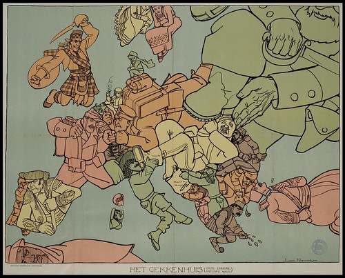
Dogs of War. Satirical Maps of the First World War


Het Gekkenhuis (Oud Liedje, Nieuwe Wijs)
{approx: The Insane Asylum (Old Song, Newly Wise (or 'new tune'?)}
(by Louis Raemaekers; Amsterdam, Senefelder [pub.] 1915)


Louis Raemaekers (1869-1956) was one of the most famous cartoonist/caricaturists of WWI. He crossed the border from Holland into Belgium to witness first-hand the atrocities of the advancing German army. He subsequently chronicled the brutality of theses forces in his cartoons which drew the wrath of the Germans. They forced the Dutch authorities to put the illustrator on trial for jeopardising the neutrality of the Netherlands (acquitted). A reward was offered by the Germans for Raemaekers' arrest and he escaped to Britain where he continued to skewer the German army in his drawings. He produced a thousand cartoons during the war and gained world wide acclaim from their syndication. {see: bio; books}

Como siempre, Bibliodissey, interminable. Para ver más información sobre mapas satíticos de Europa, usted puede ir por acá o por aquí.