Mostrando entradas con la etiqueta googleEarth. Mostrar todas las entradas

26/11/13

New Ruins. Google Earth Tour ; Manuel Fernandez, 2013.


New Ruins. Google Earth Tour is a visual geolocated 3D installation project made in Google Earth in wich the most known ancient ruin models have been remapped and reinstallated in their original places.

Exhibited at:

Transfer 3D Speed show. Internet Navig@tor. Curated by: Małgosia Woźnica and Dominik Podsiadły. Wrocław, Poland 2012
The Eternal Internet Brotherhood. Curated by Angelo Plessas. Las Pozas Surrealist Park, Xilitla, San Luis Potosi, MX 2013.
What we call sculpture. Cerma. Internet. 2013


New Ruins. Google Earth Tour


New Ruins. Tepozteco. Postcards from Google Earth. PNG Screenshot. 2013. For The Eternal Internet Brotherhood. Mexico


New Ruins. Partenon. Postcards from Google Earth. PNG Screenshot. 2012.


New Ruins. Angkor Wat. Postcards from Google Earth. PNG Screenshot. 2012.


New Ruins. Coliseum. Postcards from Google Earth. PNG Screenshot. 2012.


New Ruins. Machu Picchu. Postcards from Google Earth. PNG Screenshot. 2012.


New Ruins. Pascua Island. Postcards from Google Earth. PNG Screenshot. 2012.


New Ruins. Petra. Postcards from Google Earth. PNG Screenshot. 2012.


New Ruins. Egyptian pyramids. Postcards from Google Earth. PNG Screenshot. 2012.


New Ruins. Stonehenge. Postcards from Google Earth. PNG Screenshot. 2012.


New Ruins. Taj Mahal. Postcards from Google Earth. PNG Screenshot. 2012.


New Ruins. Tikal. Postcards from Google Earth. PNG Screenshot. 2012.

More info from Manuel Fernández here.

3/7/13

Onformative

googleFace0 googleFace2 googleFace4


Work from Google Faces
“The way we perceive our environment is a complex procedure. By the help of our vision we are able to recognize friends within a huge crowd, approximate the speed of an oncoming car or simply admire a painting. One of human’s most characteristic features is our desire to detect patterns. We use this ability to penetrate into the detailed secrets of nature. However we also tend to use this ability to enrich our imagination. Hence we recognize meaningful shapes in clouds or detect a great bear upon astrological observations.
Objective investigations and subjective imagination collide to one inseparable process. The tendency to detect meaning in vague visual stimuli is a psychological phenomenon called Pareidolia, and captures the core interest of this project.
We were driven by the idea, to explore how the psychological phenomenon of Pareidolia, could be generated by a machine. We wrote an algorithm simulating this tendency, as it continuously searches for face-like shapes while iterating above the landscapes of the earth. As a major inspiration we took a look at the “Face on Mars” taken by Viking 1 on July 25, 1976.
One of the key aspects of this project, is the autonomy of the face searching agent and the amount of data we are investigating. The source of our image data is halfway voluntary provided by Google Maps. Our agent flips through one satellite image after the other, in order to feed the face detection algorithm with landscape samples. The corresponding iteration algorithm steps sequentially along the latitude and longitude of our globe. Once the agent circumnavigated the world, it switches to the next zoom level and starts all over again.
Our Facetracker already circumnavigated the world a couple of times and astonished us with quite versatile results. As it continues to travel the world within the upcoming months, it continuously zooms into the earth. This process decreases the step-size for each iteration and therefore increases the amount of images and travel time exponentially. Some of the detected images aren’t usable at all, as we are not able to recognize any face-like patterns within the detected images. Other satellite images, on the other hand, inspired our imagination in a tremendous, yet funny way. However the search goes on, as our diligent robot continuous investigation. Below we have collected several images already found. Click on the images to see it directly on Google Maps.” -Onformative

Fom Ilikethisart.

7/8/12

Clement Valla; The Universal Texture, 2012


Clement Valla
Work from The Universal Texture (including the full post / essay from Rhizome)
These artists (…) counter the database, understood as a structure of dehumanized power, with the collection, as a form of idiosyncratic, unsystematic, and human memory. They collect what interests them, whatever they feel can and should be included in a meaning system. They describe, critique, and finally challenge the dynamics of the database, forcing it to evolve.1
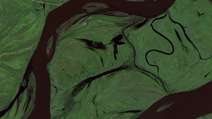
I collect Google Earth images. I discovered them by accident, these particularly strange snapshots, where the illusion of a seamless and accurate representation of the Earth’s surface seems to break down. I was Google Earth-ing, when I noticed that a striking number of buildings looked like they were upside down. I could tell there were two competing visual inputs here —the 3D model that formed the surface of the earth, and the mapping of the aerial photography; they didn’t match up. Depth cues in the aerial photographs, like shadows and lighting, were not aligning with the depth cues of the 3D model.
The competing visual inputs I had noticed produced some exceptional imagery, and I began to find more and start a collection.  At first, I thought they were glitches, or errors in the algorithm, but looking closer, I realized the situation was actually more interesting — these images are not glitches. They are the absolute logical result of the system. They are an edge condition—an anomaly within the system, a nonstandard, an outlier, even, but not an error. These jarring moments expose how Google Earth works, focusing our attention on the software. They are seams which reveal a new model of seeing and of representing our world – as dynamic, ever-changing data from a myriad of different sources – endlessly combined, constantly updated, creating a seamless illusion.
3D Images like those in Google Earth are generated through a process called texture mapping. Texture mapping is a technology developed by Ed Catmull in the 1970′s. In 3D modeling, a texture map is a flat image that gets applied to the surface of a 3D model, like a label on a can or a bottle of soda. Textures typically represent a flat expanse with very little depth of field, meant to mimic surface properties of an object. Textures are more like a scan than a photograph. The surface represented in a texture coincides with the surface of the picture plane, unlike a photograph that represents a space beyond the picture plane. This difference might be summed up another way: we see through a photograph, we look at a texture. This is an important distinction in 3D modeling, because textures are stretched across the surface of a 3D model, in essence becoming the skin for the model.
Google Earth’s textures however, are not shallow or flat. They are photographs that we look through into a space represented beyond—a space our brain interprets as having three dimensions and depth. We see space in the aerial photographs because of light and shadows and because of our prior knowledge of experienced space. When these photographs get distorted and stretched across the 3D topography of the earth, we are both looking at the distorted picture plane, and through the same picture plane at the space depicted in the texture. In other words, we are looking at two spaces simultaneously. Most of the time this doubling of spaces in Google Earth goes unnoticed, but sometimes the two spaces are so different, that things look strange, vertiginous, or plain wrong. But they’re not wrong. They reveal Google’s system used to map the earth — The Universal Texture.
The Universal Texture is a Google patent for mapping textures onto a 3D model of the entire globe.2 At its core the Universal Texture is just an optimal way to generate a texture map of the earth. As its name implies, the Universal Texture promises a god-like (or drone-like) uninterrupted navigation of our planet — not a tiled series of discrete maps, but a flowing and fluid experience. This experience is so different, so much more seamless than previous technologies, that it is an achievement quite like what the escalator did to shopping:
No invention has had the importance for and impact on shopping as the escalator. As opposed to the elevator, which is limited in terms of the numbers it can transport between different floors and which through its very mechanism insists on division, the escalator accommodates and combines any flow, efficiently creates fluid transitions between one level and another, and even blurs the distinction between separate levels and individual spaces.3
In the digital media world, this fluid continuity is analogous to the infinite scroll’s effect on Tumblr. In Google Earth, the Universal Texture delivers a smooth, complete and easily accessible knowledge of the planet’s surface. The Universal Texture is able to take a giant photo collage made up of aerial photographs from all kinds of different sources — various companies, governments, mapping institutes — and map it onto a three-dimensional model assembled from as many distinct sources. It blends these disparate data together into a seamless space – like the escalator merges floors in a shopping mall.
Our mechanical processes for creating images have habituated us into thinking in terms of snapshots – discrete segments of time and space (no matter how close together those discrete segments get, we still count in frames per second and image aspect ratios). But Google is thinking in continuity. The images produced by Google Earth are quite unlike a photograph that bears an indexical relationship to a given space at a given time. Rather, they are hybrid images, a patchwork of two-dimensional photographic data and three-dimensional topographic data extracted from a slew of sources, data-mined, pre-processed, blended and merged in real-time. Google Earth is essentially a database disguised as a photographic representation.
It is an automated, statistical, incessant, universal representation that selectively chooses its data. (For one, there is no ‘night’ in Google’s version of Earth.) The system edits a particular representation of the world. The software edits, re-assembles, processes and packages reality in order to form a very specific and useful model. These collected images feel alien, because they are clearly an incorrect representation of the earth’s surface. And it is precisely because humans did not directly create these images that they are so fascinating. They are created by an algorithm that finds nothing wrong in these moments. They are less a creation, than a kind of fact – a representation of the laws of the Universal Texture. As a collection the anomalies are a weird natural history of Google Earth’s software. They are strange new typologies, representative of a particular digital process. Typically, the illusion the Universal Texture creates makes the process itself go unnoticed, but these anomalies offer a glimpse into the data collection and assembly. They bring the diverging data sources to light. In these anomalies we understand there are competing inputs, competing data sources and discrepancy in the data. The world is not so fluid after all.
By capturing screenshots of these images in Google Earth, I am pausing them and pulling them out of the update cycle. I capture these images to archive them – to make sure there is a record that this image was produced by the Universal Texture at a particular time and place. As I kept looking for more anomalies, and revisiting anomalies I had already discovered, I noticed the images I had discovered were disappearing. The aerial photographs were getting updated, becoming ‘flatter’ – from being taken at less of an angle or having the shadows below bridges muted. Because Google Earth is constantly updating its algorithms and three-dimensional data, each specific moment could only be captured as a still image. I know Google is trying to fix some of these anomalies too – I’ve been contacted by a Google engineer who has come up with a clever fix for the problem of drooping roads and bridges. Though the change has yet to appear in the software, it’s only a matter of time.
Taking a closer look, Google’s algorithms also seem to have a way to select certain types of aerial photographs over others, so as more photographs are taken, the better ones get selected. To Google, better photographs are flatter, have fewer shadows and are taken from higher angles. Because of this progress, these strange images are being erased. I see part of my work as archiving these temporal digital typologies. I also call these images postcards to cast myself as a tourist in the temporal and virtual space – a space that exists digitally for a moment, and may perhaps never be reconstituted again by any computer.
Nothing draws more attention to the temporality of these images than the simple observation that the clouds are disappearing from Google Earth. After all, clouds obscures the surface of the planet so photos with no clouds are privileged. The Universal Texture and its attendant database algorithms are trained on a few basic qualitative traits – no clouds, high contrast, shallow depth, daylight photos. Progress in architecture has given us total control over interior environments; climate controlled spaces smoothly connected by escalators in shopping malls, airports, hotels and casinos. Progress in the Universal Texture promises to give us a smooth and continuous 24-hour, cloudless, daylit world, increasingly free of jarring anomalies, outliers and statistical inconsistency.
Notes:
(1) Quaranta, Domenico, “Collect the WWWorld. The Artist as Archivist in the Internet Age,” in Domenico Quaranta et al., Collect the WWWorld, exhibition catalogue, LINK Editions, September 2011.
(2) “WebGL Earth Documentation – 2 Real-time Texturing Methods,” WebGL Earth Documentation – 2 Real-time Texturing Methods, N.p., n.d. Web. 30 July 2012.

(3) Jovanovic Weiss, Srdjan and Leong, Sze Tsung, “Escalator,” in Koolhaas et al., Harvard Design School guide to shopping, Köln, New York, Taschen, 2001.

From Ilikethisart.

16/5/11

(1:1) Juego de escala de Antonio R. Montesinos en Alrededor es imposible; 11 y 12 de junio

Estoy muy contento anunciando la apertura de la convocatoria para participar en el workshop (1:1) Juego de escala de Antonio R. Montesinos. Es el taller que abre el proyecto Alrededor es imposible. Una exploración de lo inesperado en los sistemas cartográficos de Google, proyecto que me han seleccionado en Inéditos.

La inauguración es el 28 de junio en La Casa Encendida.

Los artistas que participan en este proyecto son:

Jesús Acevedo con Aquí.

Marc Horowitz & Peter Baldes con Google Maps Road Trip, Caminamos.

Robin Hewlett & Ben Kinsley con Street with a view.

Daniel Jacoby con Location Unreachable to Google.

Jodi con GeoGoo.

Regina de Miguel con El último término que alcanza la vista.

Max Neupert con Der Über-Blick.

Nick Newcomen con World´s biggest writing.

Jon Rafman con 9-eyes.

Antonio R. Montesinos con (1:1) Juego de escala.

Junto a la exposición, tendrán lugar tres actividades:


-
Punto de vista y perspectiva: porqué nos gusta mirar desde la órbita.

Charla y debate a cargo de Max Neupert en La Casa Encendida.

30 de Junio.


Desde el Renacimiento a periodo de las pinturas ilusionistas barrocas había siempre frescos en los techos representando los cielos con ángeles y putti. Con la iluminación la vista se desplazaba hacia el horizonte junto a imágenes panorámicas de batallas, ciudades o hacia otros milagros realizados por el hombre. La perspectiva del pensamiento de hoy es de signo orbital. Desde que Gagarin miró hacia abajo, hacia nuestro planeta desde una nave espacial, estamos fascinados por el punto de vista auto-contemplativo sobre nuestro planeta. Las aplicaciones informáticas que representan un mundo virtual instaladas en el escritorio de nuestro ordenador hacen la exploración de este punto de vista disponible a cualquiera mientras que las fuentes permanecen intensamente militarizadas y oscuras. No sabemos muchas cosas acerca de los satélites que proveen las imágenes ni somos conscientes de lo dependientes que somos de esa tecnología.

La conferencia pondrá de relieve algunos aspectos de interés histórico en la perspectiva que se interconectarán para construir una imagen mayor.

El contenido combinará la Tesis de Max Neupert [1] y su investigación actual [2]  Satellite Zodiac y el punto de vista orbital.


GoogleMapsRoadTrip/Madrid. El Caminar. The Walk.

Performance a cargo de Peter Baldes & Marc Horowitz en La Casa Encendida.

28 de junio a partir de las 12:00.

En esta nueva performance del proyecto GoogleMapsRoadTrip, Peter Baldes y Marc Horowitz estarán explorando Madrid cada uno por su parte para acabar encontrándose en el opening en La Casa Encendida.

Los visitantes a la exposición están invitados a participar a través de chat de vídeo o de texto, como si fuesen personas encontradas en la calle así como ellos hacen el  recorrido hacia La Casa Encendida “andando” en el sistema cartográfico de Google Streetview.

(1:1) Juego de escala.
Workshop a cargo de Antonio R. Montesinos en Rampa [www.proyectorampa.net]
11 y 12 de junio.


(1:1) Juego de escala es un taller que se establece como un ejercicio contradictorio que pretende crear una serie de experiencias, a medio camino entre la realidad y la ficción, mediante la utilización de las posibilidades que Google-Maps ofrece para el control del territorio. Por último pretende demostrar como esa misma experiencia puede negarse a ser presentado/controlado en su totalidad por Google-Maps.
Durante el taller se realizará una experiencia a medio camino entre el taller y juego. Se pretende tomar elementos de ambos formatos que, en el fondo, son muy parecidos: una experiencia reglamentada y simplificada dirigida o coordinada por un “maestro de ceremonias”.
El taller se plantea basándose en como ciertos juegos de rol y de estrategias construyen una historia en base a una cartografía estableciendo una relación dinámica y retro-alimentada entre la creación de un territorio y una narración. Se pretende, por tanto, realizar un ejercicio que utiliza el espacio cartográfico y virtual de Google-Maps y el espacio real de las calles de Madrid para construir una serie de narraciones que después se representarán/ocultarán un plano que constituirá la pieza final.
Este taller está dentro del proyecto Alrededor es imposibe de Lorenzo Sandoval para la convocatoria para jóvenes comisarios Inéditos de La Casa Encendida.
El proceso de la actividad se desarrollará en tres fases principales:
1 Creación de una historia/cartografía utilizando Google-Maps, exploraciones en el espacio urbano de Madrid y métodos de narración colectivos.

2 Creación de la cartografía final y un título para la narración construida.
3 Ocultación de los datos geoetiquetados, dejando sólo los tracks y tags, pero sin información alguna.
Estas tres fases constituirán las reglas de un taller/juego que producirán la pieza final consistirán en:
1 Organización de los grupos.

2 Elección de un lugar de inicio en base a las preferencias personales de cada grupo.

3 Organización de turnos de jugada y de actividades en base a la tirada de un dado piramidal de cuatro caras. Cada cara establecerá diferentes formas de creación de la narración: recogida de datos reales, memorias del lugar, trabajo de exploración y ficciones.

4 En base a la actividad que dicte el dado los participantes en el taller trabajarán la narración en base a Google-Maps o a experiencias de exploración en las calles de Madrid, en este caso se registrará la actividad mediante dispositivos GPS para su posterior implementación.. Mediante los diferentes turnos y en consenso de todos los grupos se construirá la narración.

5 Una vez construida la historia se realizará la cartografía final y la elección del título.

6 Por último se precederá a la ocultación de todos los datos narrativos, dejando sólo las referencias espaciales (tracks y tags), pero sin ninguna información.

7 Por último se realizará un plano en papel con los recorridos y sus títulos.
La pieza final será una instalación que consistirá en un plano en papel y el dado sobre una mesa, un ordenador personal con la web del proyecto, una pila de planos en miniatura con la narración completa escrita y tachada.


Más sobre este taller aquí

Y en breve subirá más info sobre Alrededor es imposible.

27/4/11

Bridges; Clement Valla, 2010


Most people have whiled away a few hours scouring the globe from above using Google Earth. However, when artist and programmer Clement Valla started thinking about how the software operates, he found images which made even the most familiar landmarks unrecognisable. 
"I began exploring areas where it would be difficult to resolve the two different media [of satellite imaging and 3D landscape] and found that bridges produced very interesting result," the Brooklyn-based artist explains. 

Indeed, it is the mix of inspiration and scepticism that Google Earth stirs in Valla which provides the concept behind his "postcards". Like many others, he first used Google Earth "out of curiosity", but while admiring it as a piece of software, Valla likes "to maintain a critical distance to these kinds of representations, trying to understand how they affect the way in which we see and interpret the world,  the way in which they affect other visual representations, and might one day replace other modes of exploring the planet."

This led to Googling the world's "tallest, longest, newest, most spectacular bridges", as well as spending hours just following roads on the satellite imaging software looking for glitches. Valla's work is a self-proclaimed "investigation of process" and the reasons behind the images' wonky perspectives are as interesting as how they came to be so. Because, while Valla's images may look processed they're actually just screenshots from Google Earth. He explains that because the Google Earth image is produced by mapping a flat, 2D satellite image image onto the 3D terrain model information, the flat image -- for example of the top of the Golden Gate Bridge -- is projected onto the terrain beneath it, the result is distortion. Or, "in other words, the bridge appears to follow the terrain that it actually goes over".

The images are further complicated by the deceptive shadowing from the satellite images. As Valla says in an interview with Wired.co.uk, "These create depth cues, so we can understand the 3D information contained in 2D images."

Valla calls these images postcards because of how they reflect the transient nature of satellite imaging. "They reflect another era, another mode of exploration, discovery and memory, another process of image creation and distribution" he explains.

"These images are frozen moments from the history of Google Earth. As the software improves and is updated, these situations may be resolved, and these images will disappear forever from the software."
That would mean losing these weird and wonderful anomalous warped bridges. It's a good job we've got a gallery full of Valla's hunted-down screengrabs for you here.

Mr John Holten sent me this.
More images here.

3/4/11

RAM_Trip [De la “nueva historiografía” a la literatura trastornada] - Miguel Á. Hernández-Navarro


“El mundo de las últimas cosas, ahora convertidas en imagen”. 
José Luis Brea

“Un lugar en el que el tiempo se expande elásticamente sin dejar de ser un solo tiempo”. 
Agustín Fernández Mallo

En una serie de artículos recientes, Ernst van Alphen ha acuñado el término “nueva historiografía” para referirse a la inclinación de un gran número de artistas visuales contemporáneos a trabajar sobre la historia y el pasado. Como un paso más dentro de las poéticas del archivo y la reflexión sobre la memoria –cuestiones centrales del arte en los noventa y principios del nuevo siglo–, esta actitud pretende activar el pasado a través de la actualización de lo histórico mediante un trabajo de “postproducción” de la realidad heredada. De este modo, los artistas trabajan como historiadores en el sentido benjaminiano del término: como traperos de la historia, reuniendo fragmentos y construyendo –nunca reconstruyendo– un nuevo vestido –un nuevo presente– con los “desechos de la historia”.
Sin lugar a dudas, esta actitud ante la historia constituye uno de los centros de tensión en torno al que se arremolina toda una faz del arte contemporáneo. Una tendencia que supone un paso más en las estrategias de trabajo sobre la memoria, pero también sobre la realidad dada. Es el lugar, podríamos decir, en el que se dan la mano el arte de la memoria y el arte de la apropiación. Y lo hacen para dar lugar a una construcción del tiempo que parte tanto del montaje y la postproducción de realidades previas –ready mades históricos– como de un sentido particular de la historia en tanto que tiempo abierto y activo que se proyecta en el presente con una presencia tangible y material. 

Entre las varias vías de trabajo con la historia, Mark Godfrey, otro teórico de estas prácticas, ha llamado la atención sobre lo que él denomina “performances históricas”: estrategias de reactualización y reactivación del pasado a través de la reelaboración de acontecimientos singulares. Se refiere Godfrey a obras como The Green Line (2004) de Francis Alÿs, en la que, a través de una caminata por Jerusalén dejando tras de sí un rastro de pintura verde, el artista belga recrea de modo irónico y poético la línea dibujada en 1948 por Moshe Dayan para delimitar los bordes del Estado de Israel. Se trata de formas de conmemoración, de recuerdo, que ya no tienen que ver con el monumento o con la memoria osificada, sino con la activación del pasado, poniendo de nuevo la realidad en circulación, sacándola al registro de lo visible, visualizando algo que, “de hecho”, afecta al presente. Recordar, por tanto, como re-mover, re-hacer, re-elaborar, pero nunca para re-construir o para re-producir, sino para problematizar y tambalear la artificialidad del tiempo-presente, mostrando la porosidad de los diversos estratos del tiempo, poniendo en contacto –y en colisión– tiempos y lugares diferentes.

El hacedor (de Borges), Remake, el último libro de Agustín Fernández Mallo (AFM), es un ejemplo paradigmático de cómo este trabajo con la historia y con la memoria acontece también en el ámbito de la literatura. De hecho, no es descabellado entenderlo como parte de esa de “nueva historiografía” tal y como ha sido establecida por van Alphen, como una manera de construir el presente a través del pasado, una reconsideración y relectura de la historia –social, política, pero también artística y literaria–. Y, aun más, quizá haya que hablar de este libro como una forma de literatura “prepóstera” en el sentido entendido por Mieke Bal en su Quoting Caravaggio: Contemporary Art, Preposterous History. Una forma que revuelve y trastoca el tiempo, que lo pliega y lo retuerce, pero también una forma ilógica, absurda e incluso irreverente. Y es que el término inglés “preposterous” tiene precisamente esos dos sentidos: uno temporal, de inversión de la cronología; y otro, relacionado con la irracionalidad y la locura, que es el de uso común. Cuando Bal ser refiere a la “preposterous History” lo hace utilizando la polisemia del vocablo. Por eso quizá sea necesario traducir su formulación según lo ha hecho Remedios Perni, como “historia trastornada”: tiempo revuelto y desorientado. Tiempo desviado o, mejor, desquiciado.

A pesar de su título, y de su propuesta, El hacedor de AFM no es un remake, al menos en el sentido tradicional del término, ese dado por Frederic Jameson en su célebre estudio sobre la posmodernidad. Jameson advirtió que el pastiche y el remake eran estrategias claves del cine –pero también del arte– postmoderno, que reproducía y replicaba modelos e historias establecidas. Recientemente, Jorge Carrión ha observado cómo esta tendencia también es central en el campo literario, y ha definido el remake de AFM como “reescritura artesanal y actualización histórica y tecnológica”. En este sentido, más que con un remake, nos encontramos con una reelaboración total. Lo que hace AFM con Borges no es exactamente un remake, sino una actualización. Es, ciertamente, una recontextualización de Borges. En algún caso concreto, como ocurre con “Del Rigor de la Ciencia” –el célebre cuento sobre el mapa de que ocupa todo el territorio–, AFM apenas introduce una palabra –Google Earth– para cambiar todo el sentido del cuento, que directamente replica del original, como el “Pierre Menard, autor del Quijote” –por cierto, uno de los textos fetiches del arte de la apropiación; introducido en la edición fundacional de Brian Wallis, El arte después de la modernidad–. Pero salvo este ejemplo de recontextualización y mínima postproducción, el resto de El hacedor de AFM es un texto que difiere absolutamente de El hacedor de JLB, pero en todo momento lo “trae al presente”, lo “hace suyo”, lo activa y lo dota de la fuerza necesaria para ser efectivo en el mundo contemporáneo.

La relectura que hace AFM de Borges es, de este modo, una actualización histórica. Una actualización preposterior: trastornada y absurda, en el sentido temporalmente subversivo del término. En particular, la “realización” del viaje de Robert Smithson por los Monumentos del Río Passaic, me parece una de las formas más lúcidas y certeras de traer al presente el sentido último de la obra de Smithson. Un “hacer presente” que, sin duda, pertenecería a eso que Godfrey llamó “performances históricas”. Volver a hacer el viaje, pero ahora sin la necesidad de ir al lugar físico. AFM vuelve a realizar el viaje, pero lo hace desde la imagen, a través de Google Earth, sentado frente a la pantalla del ordenador, experimentando una modalidad contemporánea del viaje, pero también apuntando el camino para un nuevo arte de la cartografía. Una cartografía afectiva y una nueva experiencia del viaje que denomina “psicoGooglegeografía”.

El viaje de Smithson era el de un renovado flâneur de la contemporaneidad. Igual que Walter Benjamin observaba los pasajes parisinos como las catacumbas de la modernidad, Smithson ve en las ruinas industriales del mundo contemporáneo un tiempo mítico, percibiendo las excavadoras como dinosaurios, observando cómo el tiempo se condensa y se retuerce. Los monumentos de Passaic aparecen así como una ruptura con el tiempo-presente y una introducción de un tiempo extraño que se ajusta mejor al tiempo de los sueños tal y como lo definió Freud. Tiempo condensado y alterado. Tiempo conflictivo en el que la cronología pierde su sentido. El pasado en el presente. O, mejor, el presente como pasado. Tiempo ruinoso. 

Smithson percibió las ruinas de su presente. ¿Cómo serán las ruinas de nuestro tiempo? En Homo Sampler, Eloy Fernández Porta ha hablado con lucidez de la sensación siniestra que tendríamos al enfrentarnos a la obsolescencia de la cultura de masas contemporánea: Ur-Pop o Ikea Sumergida. AFM nos habla ahora de otro tipo de ruina, la ruina digital. ¿Cuál es la modalidad de la ruina en el universo de Google Earth? ¿Cómo se olvida en la era de la imagen del mundo?
Escribe Borges en el texto original de “Mutaciones” –el que Fernández reelabora para su reactualización del viaje de Smithson–: “Cruz, lazo y flecha, viejos utensilios del hombre, hoy rebajados o elevados a símbolos; no sé por qué me maravillan, cuando no hay en la tierra una sola cosa que el olvido no borre o que la memoria no altere y cuando nadie sabe en qué imágenes lo traducirá el porvenir”. Esta es la pregunta que intenta responder AFM con su viaje. El porvenir ha llevado las ruinas de la contemporaneidad a las grietas del código binario. 

Fernández Mallo actualiza el viaje de Smithson, como también lo hace con otra serie de viajes y momentos célebres. Recorrer lo recorrido, emular el célebre viaje del escritor, del artista, revivir la experiencia del acontecimiento… es parte de la experiencia nostálgica moderna. En este caso, sin embargo, la experiencia no es puro remake nostálgico y fetichista, sino actualización. Y eso es lo realmente relevante. Porque lo que hace AFM es darle sentido al viaje de Smithson y reactivarlo. No repetirlo paródicamente, sino, en cierto modo, darle su sentido último –un sentido en sí mismo contradictorio y paradójico–, casi como si estuviese trabajando en “acción diferida”. 

El remake, por tanto, no como farsa o parodia –como decía Hegel que se repetía la historia–, sino como cumplimiento, como revitalización, como verdadera puesta en juego de la memoria. Memoria que, por supuesto, acontece ahora como Memoria RAM, memoria de proceso, de flujo constante, que moviliza y ofrece energía a la memoria muda y desconectada del archivo ROM. Ésa es la memoria que hace presente El hacedor de AFM, procesando –en todos los sentidos del término– El hacedor de JLB.
Viaje en el tiempo. Viaje tiempo a través. Viaje de la imagen. Viaje en la memoria. Ram_Trip, habría que escribir. Y volver a recordar entonces, también en modo ram, a otro JLB.
Desde Salonkritik.