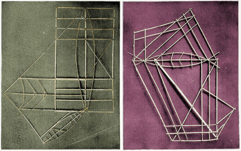
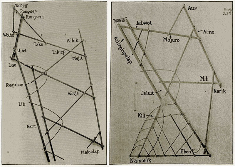
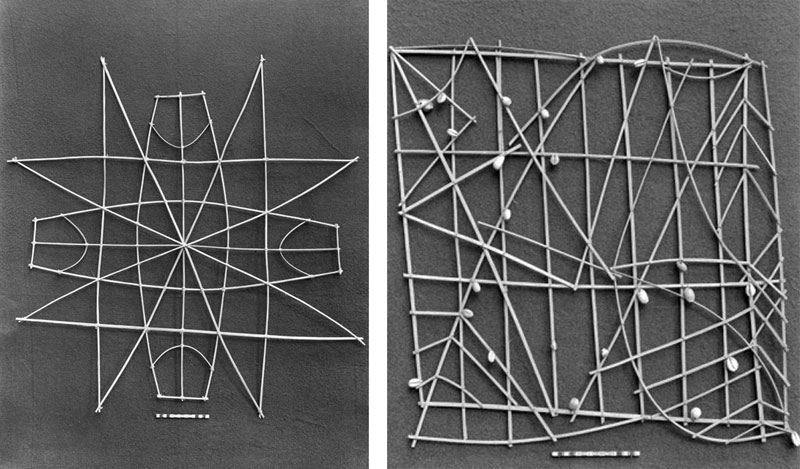
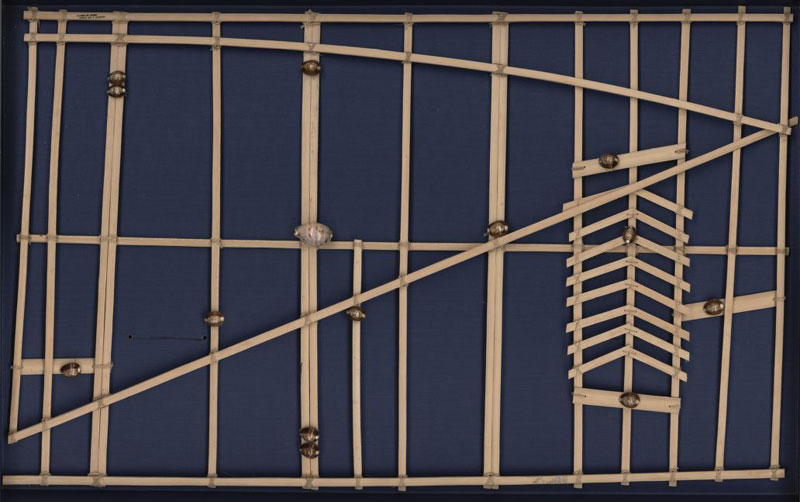
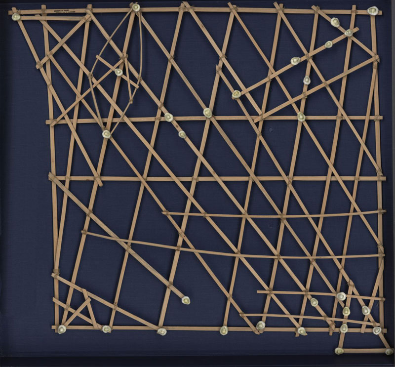
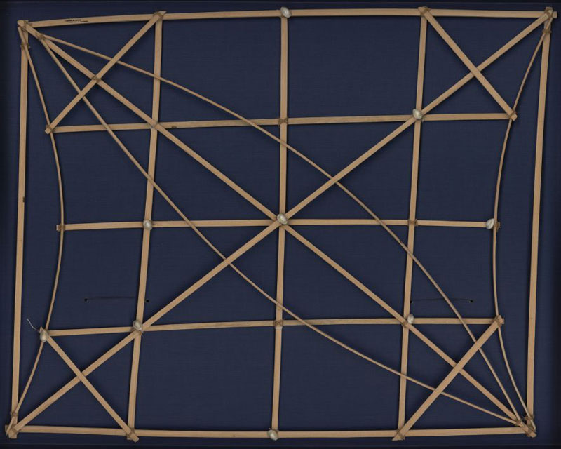
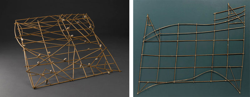
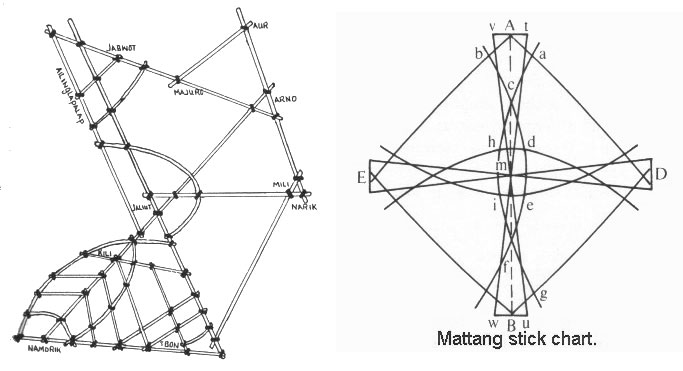
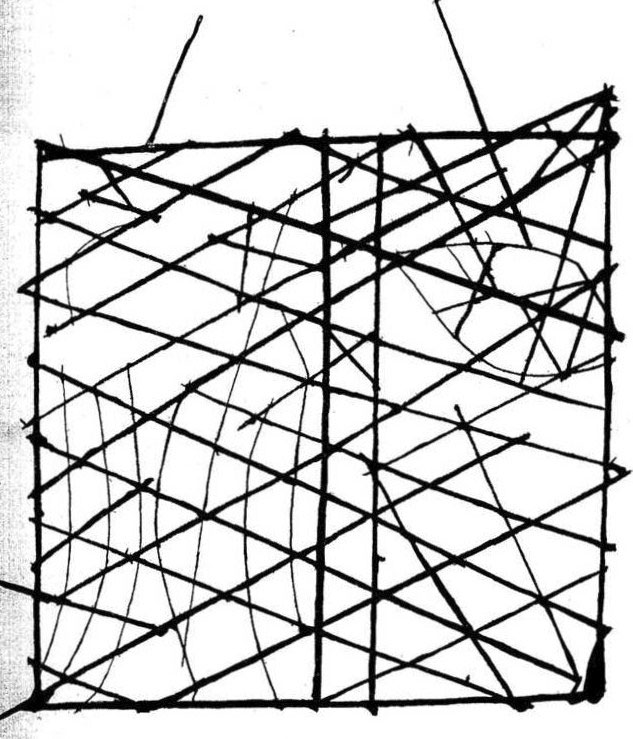
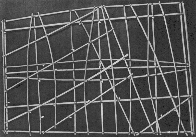
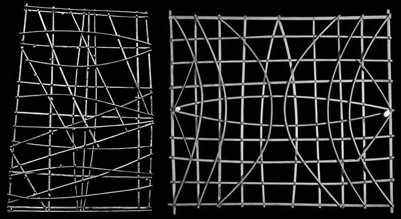
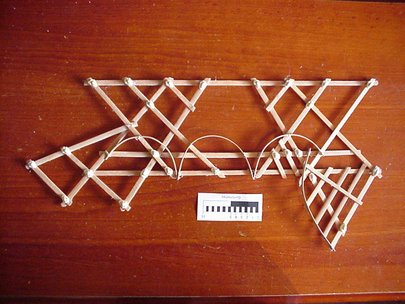
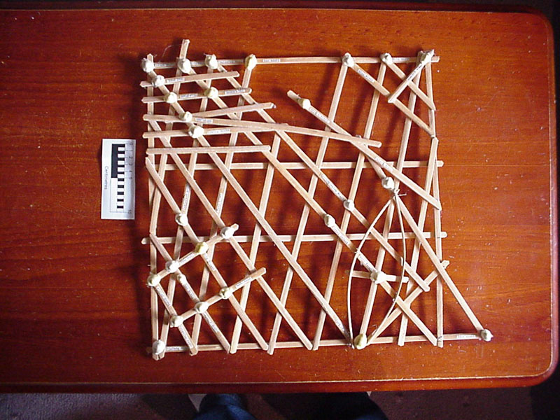
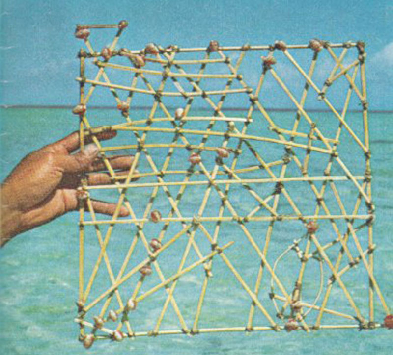
The stick charts were the main tool the Marshallese used to navigate on canoe across the islands of the Pacific Ocean, until WWII. Lacking astrolabes, sextants or even a compass, they would rely on maps made up by midribs of coconut fronds tied together to form an open framework. The location of the islands was represented by shells tied to the framework or by the lashed junction of two or more sticks. The threads were used to map ocean swells, the prevailing ocean surface wave-crests and the directions they followed to approach an island. The stick charts represented a very interesting form of cartography encoding informations not traditionally included in navigation maps.
Each chart stick is unique and was made by an individual navigator who was therefore the only person able to fully interpret and use it. The maps were not taken along during navigation, but studied and memorized prior to a trip. The Marshallese navigator would crouch down or lying prone in the canoe to feel how the hull was being pitched and rolled by underlying swells.
There are three main categories of stick charts: Mattang, Meddo (or Medo), and Rebbelib (or Rebbelith).
The Mattang stick chart was an abstract chart used for instructions and for teaching principles of reading how islands disrupt swells.
The Meddo chart showed actual islands and their relative or exact positions.
The Rebbelib charts portrayed the same information as a Meddo chart, but unlike them, included all or most of one or both chains of islands.
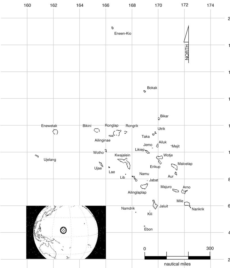
Map and Global Position of the Marshall Islands
Contributed by Antonio R. Montesinos.
No hay comentarios:
Publicar un comentario