Around is impossible.
(An exploration of the unexpected in the cartographical systems of Google)
The concept of Terra incognita was used since the century XVI till the century XIX to refer to the non-explored areas of the world. Cartographers stopped writing it in maps when geographical associations started proliferating and the earth became fully known and represented. These unknown and dangerous zones would also be represented by monstrous creatures (the famous phrase Here be dragons). This concept was used to refer to the world beyond the limits of the Earth, as for the interior areas in continents, like interior Africa. Therefore, there was always a border, a space around it where one would be able to quest for a fictional world, a line beyond which the imagination would open its door, generating fears and the desire for the unexpected.
Between a drawing of the World through cartography and the sky existed a relation of continuity: the first known maps are those that represented celestial constellations, the spherical form of the earth was found through the shadows projected by the sun, and the Polar star was what was used in the north hemisphere – where the mapping technology had been mostly developed –to identify the north. There is, therefore, a close relation between astronomy and cartography, we would further argue that also with astrology: drawing the world was almost equivalent to draw the divine eyes situated in the celestial sphere. A point of view similar to those of the satellites.
There is a direct relation between drawing maps and controlling territories and people: either as in army technology for conquer, in economic development, or in the scientific cataloguing of the Whole world under the colonial parameters. Through the reading of an IP while our Google profile is active, we have a spatial positioning. Moreover, through the data of our own profile or the location of the IP, the map draws its own center.
The cartographic systems of Google are a Total instrument: in its extreme voracity to represent of all the corners of the World include even what were the ways to confront the colonialist representations. As Estrella de Diego would argue in his book “Contra el mapa” (Against the map), Joaquin Torres García illustrates an inverted map of South America in his article “La escuela del sur”(the school of the south) in 1935 as a means to revise the existing western proposals of spatial order and planning. Among the many options of Googlemaps, this one of disordination is also included.
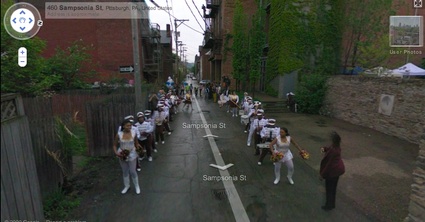
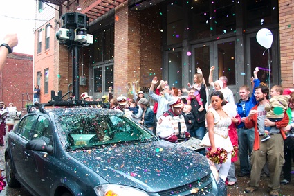
Bringing again the unexpected (or producing it) in those worldviews, as the artists in this exhibition do, is the way to escape from the drawing of the world as an identical whole.
The works in this exhibition are from the following artists: Jesús Acevedo, Robin Hewlett & Ben Kinsley, Regina de Miguel and Nick Newcomen. Curated by Lorenzo Sandoval.
****************************
14.10.10 21:00
Altes Finanzamt, Schönstedtstraße 7 - EG Neukölln 12043 Berlin Access through the yard
U7 Rathaus Neukölln (Exit Schönstedtstraße)
****************************
Alrededor es imposible.
(Una exploración de lo inesperado en los sistemas cartográficos de Google)
El concepto de Terra incógnita se usó en cartografía desde el s. XVI hasta el s. XIX para designar las zonas no exploradas del mundo. Dejó de escribirse en los mapas a partir del periodo en el que las asociaciones geográficas comenzaron a proliferar y la Tierra pasó a ser por entero conocida y representada. Esa zona desconocida y peligrosa también se representaba mediante criaturas monstruosas (el clásico Here be dragons). El término se utilizaba tanto para el más allá de los confines de la Tierra como para zonas interiores de continentes, como el África interior. Había por tanto siempre un borde, un espacio alrededor desde donde saltar en busca de lo fantástico, una línea en la que la imaginación abría sus puertas hacia los miedos y los deseos de lo inesperado.
Entre el diseño del mundo mediante la cartografía y el cielo había una relación de continuidad: los primeros mapas conocidos son aquellos que representaban las constelaciones celestes, la forma esférica de la Tierra fue hallada en relación matemática con las sombras proyectadas por el Sol y la Estrella Polar ha sido la que en el hemisferio norte -en el cuál se ha desarrollado la tecnología de los mapas – ha marcada el norte. Hay por tanto una relación próxima entre astronomía y cartografía; diríamos incluso con la astrología: diseñar el mundo era casi un equivalente a dibujar con ojos divinos situados en la esfera celeste. Un punto de vista igual al de los satélites.
Existe una correspondencia directa entre el diseño de mapas con el control de los territorios y las personas: ya sea cómo tecnología militar de conquista, el desarrollo económico o la catalogación científica del total del mundo bajo los parámetros colonialistas. Mediante la lectura de IP cuando el perfil de Google se encuentra activo, tenemos un posicionamiento espacial controlado. Incluso según los datos de nuestro perfil o la situación de la IP el mapa dibuja su centro.
Los sistemas de cartografía de Google son una herramienta total: en su voracidad absoluta de representación de todos los rincones incluyen incluso hasta lo que fueron las formas de enfrentarse a las representaciones colonialistas. Como nos cuenta Estrella de Diego en el libro Contra el mapa, Joaquín Torres García ilustra con un mapa invertido de Sudamérica su artículo “La escuela del sur” en 1935 para revisar las propuestas occidentales de ordenación territorial. Entre las opciones de Googlemaps, esta forma de desordenación está incluida.
Volver a buscar lo inesperado (o producirlo) en esas representaciones del mundo, como hacen los artistas incluidos en la exposición, es la manera de escapar al diseño del planeta como un todo idéntico.
Los trabajos que componen la exposición son de Jesús Acevedo, Robin Hewlett & Ben Kinsley, Regina de Miguel y Nick Newcomen. Comisariado por Lorenzo Sandoval.
****************************
14.10.10 21:00
Altes Finanzamt, Schönstedtstraße 7 - EG Neukölln 12043 Berlin Access through the yard
U7 Rathaus Neukölln (Exit Schönstedtstraße)