Mostrando entradas con la etiqueta Altes Finanzamt. Mostrar todas las entradas

13/10/10

Around is impossible(An exploration of the unexpected in the cartographical systems of Google) ; Altes Finanzamt, 14.10.10


Around is impossible.

(An exploration of the unexpected in the cartographical systems of Google)

The concept of Terra incognita was used since the century XVI till the century XIX to refer to the non-explored areas of the world. Cartographers stopped writing it in maps when geographical associations started proliferating and the earth became fully known and represented. These unknown and dangerous zones would also be represented by monstrous creatures (the famous phrase Here be dragons). This concept was used to refer to the world beyond the limits of the Earth, as for the interior areas in continents, like interior Africa. Therefore, there was always a border, a space around it where one would be able to quest for a fictional world, a line beyond which the imagination would open its door, generating fears and the desire for the unexpected.

Between a drawing of the World through cartography and the sky existed a relation of continuity: the first known maps are those that represented celestial constellations, the spherical form of the earth was found through the shadows projected by the sun, and the Polar star was what was used in the north hemisphere – where the mapping technology had been mostly developed –to identify the north. There is, therefore, a close relation between astronomy and cartography, we would further argue that also with astrology: drawing the world was almost equivalent to draw the divine eyes situated in the celestial sphere. A point of view similar to those of the satellites.

There is a direct relation between drawing maps and controlling territories and people: either as in army technology for conquer, in economic development, or in the scientific cataloguing of the Whole world under the colonial parameters. Through the reading of an IP while our Google profile is active, we have a spatial positioning. Moreover, through the data of our own profile or the location of the IP, the map draws its own center.

The cartographic systems of Google are a Total instrument: in its extreme voracity to represent of all the corners of the World include even what were the ways to confront the colonialist representations. As Estrella de Diego would argue in his book “Contra el mapa” (Against the map), Joaquin Torres García illustrates an inverted map of South America in his article “La escuela del sur”(the school of the south) in 1935 as a means to revise the existing western proposals of spatial order and planning. Among the many options of Googlemaps, this one of disordination is also included.

Bringing again the unexpected (or producing it) in those worldviews, as the artists in this exhibition do, is the way to escape from the drawing of the world as an identical whole.

The works in this exhibition are from the following artists: Jesús Acevedo, Robin Hewlett & Ben Kinsley, Regina de Miguel and Nick Newcomen. Curated by Lorenzo Sandoval.

****************************

14.10.10 21:00

Altes Finanzamt, Schönstedtstraße 7 - EG Neukölln 12043 Berlin Access through the yard

U7 Rathaus Neukölln (Exit Schönstedtstraße)

****************************

Alrededor es imposible.

(Una exploración de lo inesperado en los sistemas cartográficos de Google)

El concepto de Terra incógnita se usó en cartografía desde el s. XVI hasta el s. XIX para designar las zonas no exploradas del mundo. Dejó de escribirse en los mapas a partir del periodo en el que las asociaciones geográficas comenzaron a proliferar y la Tierra pasó a ser por entero conocida y representada. Esa zona desconocida y peligrosa también se representaba mediante criaturas monstruosas (el clásico Here be dragons). El término se utilizaba tanto para el más allá de los confines de la Tierra como para zonas interiores de continentes, como el África interior. Había por tanto siempre un borde, un espacio alrededor desde donde saltar en busca de lo fantástico, una línea en la que la imaginación abría sus puertas hacia los miedos y los deseos de lo inesperado.

Entre el diseño del mundo mediante la cartografía y el cielo había una relación de continuidad: los primeros mapas conocidos son aquellos que representaban las constelaciones celestes, la forma esférica de la Tierra fue hallada en relación matemática con las sombras proyectadas por el Sol y la Estrella Polar ha sido la que en el hemisferio norte -en el cuál se ha desarrollado la tecnología de los mapas – ha marcada el norte. Hay por tanto una relación próxima entre astronomía y cartografía; diríamos incluso con la astrología: diseñar el mundo era casi un equivalente a dibujar con ojos divinos situados en la esfera celeste. Un punto de vista igual al de los satélites.

Existe una correspondencia directa entre el diseño de mapas con el control de los territorios y las personas: ya sea cómo tecnología militar de conquista, el desarrollo económico o la catalogación científica del total del mundo bajo los parámetros colonialistas. Mediante la lectura de IP cuando el perfil de Google se encuentra activo, tenemos un posicionamiento espacial controlado. Incluso según los datos de nuestro perfil o la situación de la IP el mapa dibuja su centro.

Los sistemas de cartografía de Google son una herramienta total: en su voracidad absoluta de representación de todos los rincones incluyen incluso hasta lo que fueron las formas de enfrentarse a las representaciones colonialistas. Como nos cuenta Estrella de Diego en el libro Contra el mapa, Joaquín Torres García ilustra con un mapa invertido de Sudamérica su artículo “La escuela del sur” en 1935 para revisar las propuestas occidentales de ordenación territorial. Entre las opciones de Googlemaps, esta forma de desordenación está incluida.

Volver a buscar lo inesperado (o producirlo) en esas representaciones del mundo, como hacen los artistas incluidos en la exposición, es la manera de escapar al diseño del planeta como un todo idéntico.

Los trabajos que componen la exposición son de Jesús Acevedo, Robin Hewlett & Ben Kinsley, Regina de Miguel y Nick Newcomen. Comisariado por Lorenzo Sandoval.

****************************

14.10.10 21:00

Altes Finanzamt, Schönstedtstraße 7 - EG Neukölln 12043 Berlin Access through the yard

U7 Rathaus Neukölln (Exit Schönstedtstraße)

15/6/10

Displacement Series #03: Open Talks + Teufelsberg


Ayer los de PISO organizamos en el Altes Finanzamt el primero de los Open talks dentro del proyecto Displacement:
Displacement Project - PISO Colective

Within the scope of what has been called the creative class, it has been developed an ongoing need for mobility, either by weak labour conditions that force someone to move in order to search for subsistence; or due to the desire of accessing ‘’ways of doing’’, different from the departure point.
Beyond judging this need as a positive or a negative influence, we have initiated a process of research on how the notion of Displacement affects processes of cultural production.
One of the main reasons why we took this concept lies in its breadth _ in its polysemic capacity and in the multiplicity of its narrative pathways, not necessarily linear. Thanks to this, we can analyze cause and effect, reference and referent from a creative reading attitude.
Displacement is a generative process, through which Piso Collective articulates a dynamic series of work that reflect on interrelated concepts with the idea of:
cultural production, space, place, nation, border, territory, travel, symbol,
history, context, de-contextualization, identity, network, self-organization,
strength/resistance, empathy, otherness, anachronism, mirror neurons, sequence,
dyslexia, shift, memory, eco ...

Displacement Series: Open Talks
In June we initiate a series of conversations with invited collaborators.
These working tables will be documented to create an archive to be integrated in the exhibitions and available in our webpage.
The guests that will present their projects this month are
Rinus Van Alebeek (musician, writer and Staalplaat organizer)
and
Jonathan Saldanha (musician, researcher and Soopa Colective/ Label director)
After the conversation the Rinus Van Alebeek and Jonathan Saldanha will present a very special improvisation using the content of the "normationist" drifting road trip tapes that were recorded in 2005.


Los hinterhof de Berlín son como patios de vecinos pero tienen la cualidad de en muchas ocasiones permanecer abiertos y de alguna manera, semi-públicos; yo siempre que veo la oportunidad, entro en ellos a ver que me encuentro: tiendas de segunda mano, arquitecturas interesantes, espacios culturales independientes o simplementes lugares agradables.

El open talk fué en el Hinterhof del Altes Finanzamt dónde hay una bonita mesa de madera (y otra de ping pong a la que le estamos sacando mucho rendimiento). Esta mesa suele ser sitio dónde a veces algunos de los chavales del barrio mayoritariamente turco de Neukölln se reunen para fumar unos pitillos por tarde. Ayer, cuando iniciamos la presentación del proyecto, un grupo de chavales se presentó allí y se encontró su (¿nuestro?) espacio ocupado.

Trás una primera fase de cierto cachondeo, le explicamos el tema sobre el que estabamos trabajando, el displacement, y se intregaron a la charla durante un rato y mientras Rinus y Jonathan presentaban sus proyectos -que se formalizan con performance, sonido y publicaciones de discos/cassettes-, tomaron la palabra e introdujeron allí dentro de la conversación durante el rato que estuvieron el conflicto que hay entre Israel y Turquía.

No deja de ser curioso que estos chicos introdujesen ese tema del conflicto para aborar la temática central de nuestro proyecto.

Los proyectos tanto de Rinus como de Jonathan se formalizan con sonido como decía arriba. Pero el discurso que realizan tienen de una forma muy consciente en su elaboración las relaciones que surgen entre la idea de viaje, la ficción y su relación con lo real, la mística, la cartografía, la representación del territorio y el uso de la tecnología que se sobre este se hace.


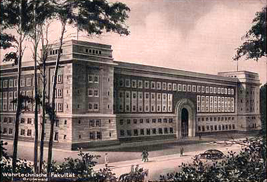
Geplante Wehrtechnische Fakultät

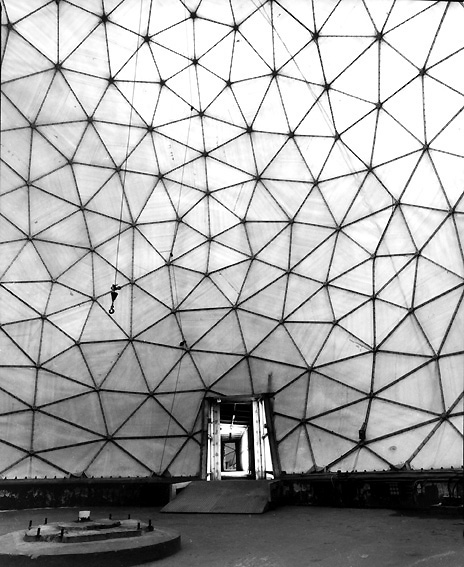
Uno de los puntos fuertes sobre los que la conversación pasó fué la relación que existe entre sonoridad, representación, mística, arquitectura y tecnología de guerra: el proyecto que Jonathan esta desarrollando este mes en Berlín estudia la sonoridad propia de Teufelsberg, estación de radar contruida para el espionaje en la Colina del diablo, una montaña artifical contruida con la acumulación gigantesca de los restos de las ruinas de Berlín tras la II Guerra Mundial y asentada sobre la escuela militar (Wehrtechnische Fakultät) del arquitecto nazi Albert Speer.
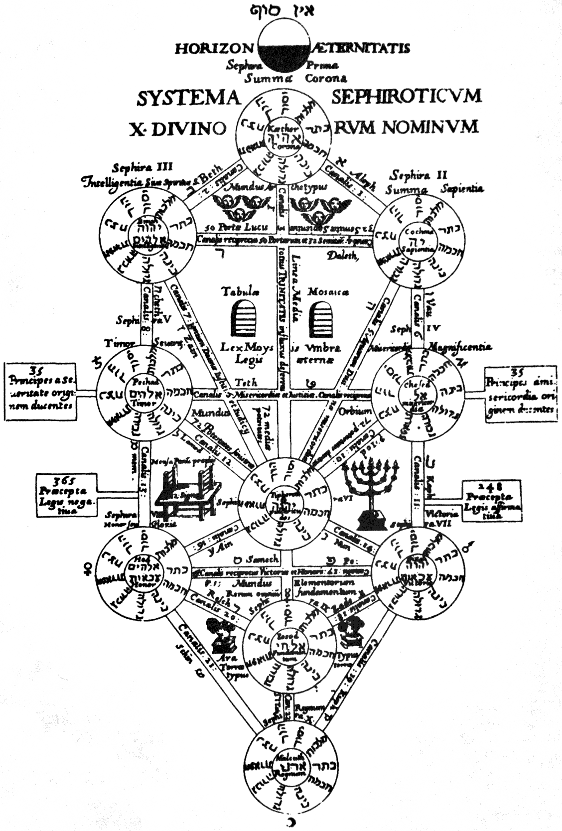
Tree of life, Athanasius Kirchner

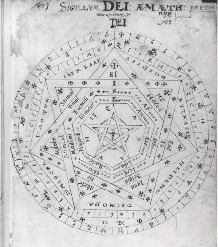
Es de sobra conocido el interés que los nazis tenían por la parapsicología, el ocultismo y el sistema místico de energía Vril (atención, que esta energía venía de un cuento de ficción del siglo XIX). Jonathan en su investigación emparenta esta referencia con el amigo íntimo del gran cartógrafo Mercator, el también cartógrafo, estudiante de la Cábala y mago John Dee:

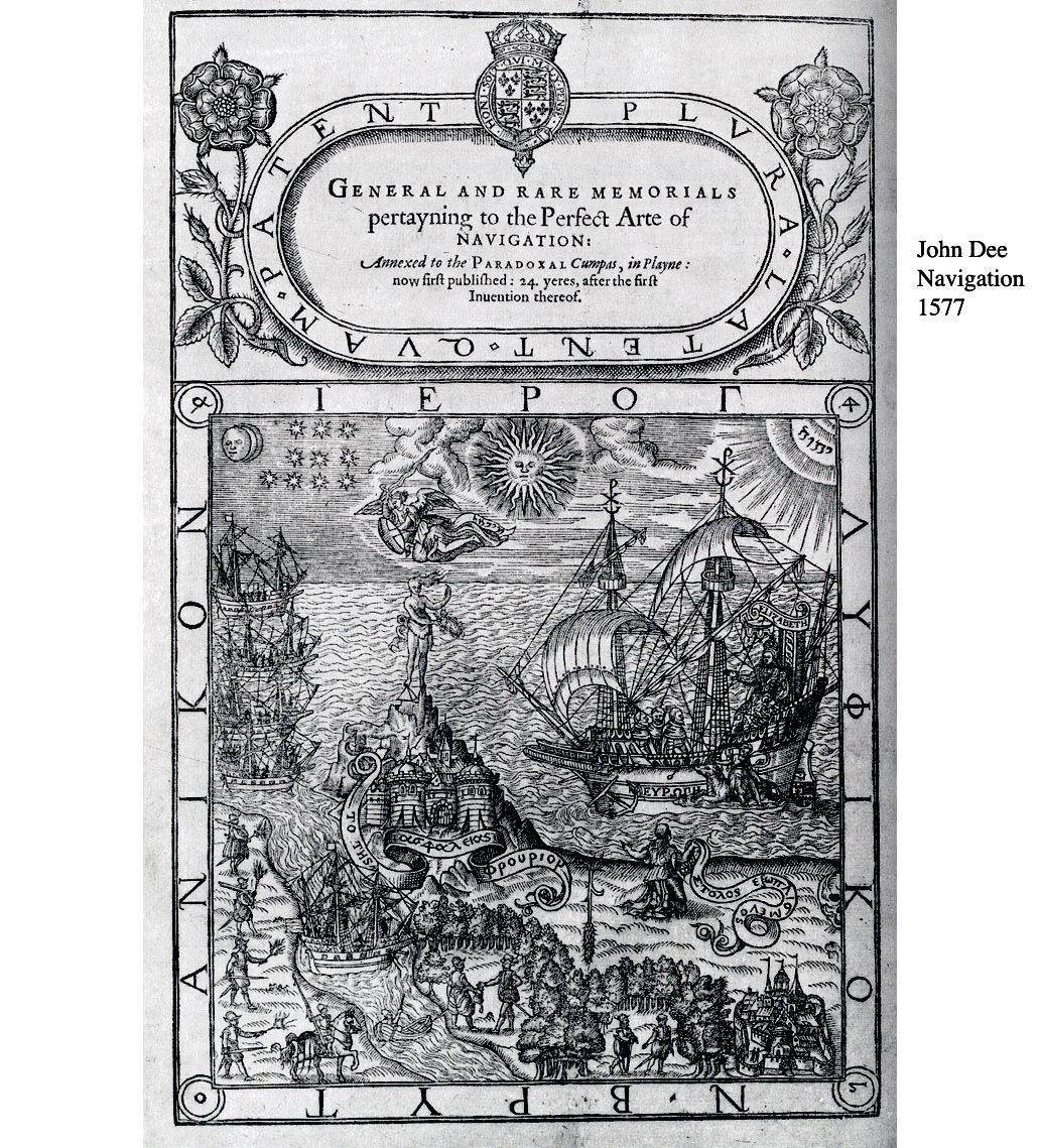
Navigation, John Dee, 1577

Navigation, Instruments, Cartography Almost by definition his astrological activities had practical ends in view, but I am not listing astrology as a technology. Advice on navigation and expedition projects, especially for the Muscovy Company for more than thirty years, from about 1551 to 1583. He prepared, or helped to prepare, a considerable list of considerable pilots, including Richard Chancellor, Stephen and William Borough, Martin Frobisher, Humphrey Gilbert, John Davis, and Walter Raleigh. He wrote the Perfect Arte of Navigation (which is, I gather, more about the geography of exploration than about the science of navigation), 1577. He is said to have made optical instruments, though I hardly know what this could mean. He did bring astronomical and navigational instruments into England when he returned from the continent in 1550. About 1553 he developed what he called the paradoxal compass and/or paradoxal chart. One source calls it a circumpolar chart for navigation in polar regions. Taylor (whom I trust) calls it a device for laying out a series of rhumbs that would lie along a great circle route. There was also a compass of variation. He designed a large radius astronomicus for Thomas Digges to observe the new star of 1572. Dee continued to work at the development of scientific instruments. While consultant to the Muscovy Company Dee assembled geographic and nautical information and prepared charts for navigation in the polar regions. De Smet calls him the central figure in the development of scientific cartography in England, and he suggests that Dee's influence was transmitted to the Netherlands where it helped form Dutch cartography in its so-called golden age.

(...)

John Dee's 1582 polar chart

(...)
From 1570 Dee advocated a policy of political and economic strengthening of England and imperial expansion into the New World. In his manuscript, Brytannicae reipublicae synopsis (1570), he outlined the current state of the Elizabethan Realm and was concerned with trade, ethics, and national strength. His 1576 General and rare memorials pertayning to the Perfect Arte of Navigation, was the first volume in an unfinished series planned to advocate the rise of imperial expansion. In the highly symbolic frontispiece, Dee included a figure of Britannia kneeling by the shore beseeching Elizabeth I, to protect her empire by strengthening her navy. Dee used Geoffrey's inclusion of Ireland in Arthur's imperial conquests to argue that Arthur had established a ‘British empire’ abroad. He further argued that England exploit new lands through colonization and this vision could become reality through maritime supremacy. In making these arguments, Dee is credited with the earliest use in English of the terms Brytish Iles and Brytish Impire.

(...)

Diagram of Sigillum Dei Aemeth, John Dee, 1582

En este cruce de refentes, lo interesante que se resaltaba en la charla eran los parelismos que hay entre ocultismo y ciencia, entre tecnología y muerte, entre cartografías e invasión.

También podríamos señalar cómo coincide en las mismas figuras científico-políticas el desarrollo de las herramientas de navegación y la idea de Imperio, cómo en su propia genealogía ya está impresa -lo veíamos más arriba en la bio de John Dee- la idea de colonialismo con todo lo que ello conlleva, cómo la cartografía es una organización del mundo, incluso siendo ficcional como bien explica Estrella de Diego en Contra el mapa.

Perderse puede ser un intento a escapar a la lógica del mapa como haría Yoko Ono en la pieza en texto en la primavera de 1964:

Map Piece
Dibuja un mapa para perderte